Showing posts with label Flying. Show all posts

Sunday, October 23, 2022

2022 Landing survey

 In August this year, I had a bit of a rough landing, or at least it felt as such. It was the classical LS6 trap : too slow on final approach with Landing flap configuration extended, resulting into nose up attitude in flare to compensate for quasi-stalled status, and tails hitting the ground first.

During 2022 season, quite a lot of data was recorded using the XC vario installed on the LS6. I have taken here the opportunity to have a survey on glider parameters during some of the landings, with the objective to analyse the specific rough landing event.

In a first plot, indicated airspeed is plotted over the last 30 second before touch down, as well as the difference between airspeed & ground speed (hence vertical wind profile) in the last 60m above touch down. Touch down is then hapenning @ t=0/Zp=0.

Indicated speed vs time & vertical profile of headwind

Those plots cover landings on 3 airfields : Aire sur adours in may, Moissac in July & August, St Auban end of August/beg September.  The rough landing happened on the 15th of august at my home airfield of Moissac, corresponding to red curve.

Here are some basic observations :

  •  In the landings recorded, indicated airspeed reading in approach (left curves), 20sec before touch down, varies from 95kph to 120kph.
    Recordings are converging at touch down toward a 80-to-90kph narrower band.
  • 15th of august landing (red) happened for the approach at the lowest speed
    --> 95 kph 20sec before touch down, 90kph 2sec before touch down, 80kph at touch down
    AND it resulted in a landing perceived as rough
  • July flight (black) was performed with a speed almost as low
    --> 95 kph 20sec before touch down, 90kph 2sec before touch down, 85kph at touch down
    BUT it did not result in a landing perceived as rough
  • Difference between red & black is the wind (right curves) : in july there was virtually no wind, whereas 15th of august landing happened in a moderate wind (~15kph in altitude), showing a 5 to 10kph wind gradient over the last 5m over ground

What is being taught to pupils ("you shall increased your approach speed on windy days") is here shown measurable, since very similar speed scheduling resulted in a different outcome at touchdown on a calm & on a windy day.
On the other hand, approach realised with greater speed margin repeatably led to "normal landing" feeling, even in wind up to 30kph.

More measurements are available from XC vario sensors : in a second plot, altitude & velocity time histories are presented over the last 30seconds before touch down, as well as vertical velocity, vertical accelerometer reading, pitch attitude & pitch rate in the last 5 seconds before touche down.

Time history for altitude, indicated airspeed, vertical speed & acceleration, pitch & pitch rate

Here are a few observations :

  •  It looks like I tend to realise lower approach at my home airfield (red, black, green) than on other airfields...
  • Like for airspeed, altitude time histories converges into a narrow band over the last 20m/10sec before touch down
  • Rolling phases correspond to high noise on many sensor of XCs vario (static & differential pressures, accelerations, roations rates), corresponding both to higher excitation (runways are not always regular) and local vibration behavior for the canopy mounted XC vario instrument.

More specificaly related to the sensation for a rough landing :

  • Red corresponds to the highest vertical speed at touch down, and black the closest to zero : it confirms the different perception at touch down for those two "low indicated speed approaches".
  • On green curve, 3-to-2 sec before touch down there is a anticipated flare, with temporary nose up attitude resulting in vertical speed reduction.
    It constrasts with red, for which nose up attitude just before touch down seems to have had no impact on vertical speed variation rate. Likely, quasi-stalled wing status due to lower speed/higher aoa in the last seconds prevented wing lift to develop further following to pitch action, preventing fine tuning of the vertical trajectory.
  • Accelerometer is quite shaky once the glider is rolling, easily showing +2.7G reading whatever the landing : high values of positive Az does not correspond by itself to the feeling for a rough landing.
    On the other hand, red curve shows at touch down a significantly negative reading (-2.7Gs) followed by a significant positive value (+3.1Gs). This signature is likely to results in the perception of a rough landing.
  • This specific signature can be understood as follows :
    • Red curves shows the highest pitch attitude at touch down
    • A significant nose down pitch rate after touch down ishould be the signature for a tail strike.
      Negative pitch acceleration results in a negative vertical acceleration measured on the instrument panel location - but also in pilot stomach to a certain extend...
    • Shortly after tail, main wheel is touching the ground as well, stopping the pitch down motion & restoring positive acceleration felt in the canopy of the glider & in pilot's stomach...

All in all, recording XC-vario parameters proved very usefull to understand what happened, recalling the basics that I was taught as a pupil in term of speed scheduling in approach...


Friday, December 24, 2021

Observing temperature profile while flying thermals

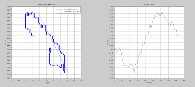
Temperature as well as static pressure are measured by XC vario. As a results, it is possible to plot temperature as function of pressure altitude. 


Below are plotted a few time slices as recorded. Several observation can be made :

  • Flying straight in sink or neutral zone results in measuring a certain gradient of temperature versus altitude - generally steeper than -6.5deg standart atmosphere gradient.
  • Circling & climbing in a thermal shows a similar temperature gradient versus altitude compared to measured in straight flight, but with an offset corresponding to warmer air
  • While entering or exiting the thermal, a transition happens in the same order of magnitude : we end up drawing an hysteresis
  • The greater the climb, the greater the "warm offset"
  • Those observations seem to remain true for strong climb in mountain area as well as weak thermal over flat land on a poor day

Using temperature sensor as a "thermal sniffer" is not the objective here, nevertheless collecting this data could be worthwhile  in term of validating weather models - particularly if coming from a network of gliders flying the same area.

 ----------------------

 Strong thermal at Malaup montain on the 13th of september 2021

  • Transition
  • 3.95m/s mean value over 850m climb
  • Transition


 ----------------------

Good thermal at La Molière (north Vercors) on the 13th of september 2021

  • Transition in a uplift area, then sink
  • 2.1m/s mean value over 320m climb
  • Transition


 ----------------------

Soft climb at Gache mountain on the 13th of september 2021
  • Transition
  • 1.1m/s mean value over 370m climb
  • Transition

 ----------------------

Weak thermal over flat land on the 9th of october 2021

  • Transition
  • 0.6m/s mean value over 100m climb
  • Transition 


Thursday, February 20, 2020

Flights from St Crepin

2019 was the opportunity to discover a new airfield, with the family onboard : nice mix of hiking & flying ! Thanks for the Bada tribe for the spot !


A few photos !

Classical view of the Ecrin
Outlanding in Aoste, Italy - Thanks to Boris for retrieval
Hiking toward Glacier Blanc
Evening welcome

Wednesday, December 30, 2015

2015 aerial shots

A few aerial shot put together...

Sunday, November 22, 2015

Flying the Pyrénées from LNFQ

This year again, we did go for 2 weeks joint family & gliding summer holyday close to an airfield. Not in this alps this time, but closer to our home, in the Pyrénées.

The choice : LFNQ - Mont Louis la Quillanne, a quite specific airfield. It is located on east side of Pyrénées very close to spanish border in Catalunya (20km from La Cerdanya), on top of "col de la Quillanne" pass.


One clear interest relates for the nice environement for family activities. There are numerous things to do, like hiking, going to local Zoo, visiting castles (this is a border area...) or bathing in thermal springs. And for sure, an airfield is always a nice place to run and play, providing some ground rules are set !


Another good point : accomodation sits directly on the airfield ! Take off & landing can be spotted from the house...


LFNQ is sitting as high as 1700m (~FL056 QNH) (!), but with a 1100m confortable grass strip.  QFU is either downhill & tailwind for moderate to medium breaze, either uphill when north wing is installed (with some local rotor & dowdraft).
Luckily towing A/C is a typical Morane 894 Rallye with a 235hp engine, that is big engine allows to have a good safety margin when taking off, even with two seaters.


On the other hand, landing is always uphill, with the altitude effect & tailwind more than 140kph ground speed in flare is common ! Still with a quite soft 1100m grass strip, there is quite some room for breaking...


Sending a text before landing is possible to get welcoming crew ! ;-)


In term of flying,I got a "tour" of the neighborhood with Jean louis, a local instructor & X-country pilot. Then I could discover local specificities.
Here are the direct surrounding of the airfield : from right to left,  Mont louis & the airfield over the "col de la quillanne" pass, Matemale lake, Super Bolquere & Font Romeu ski resorts.


I could fly over some place we have visited with the family, like Llivia & (a little area of spanish territory inside fFrance), with its former castle on top of the hill.


Also Dorres outdoor  thermal springs (just on the wing tip).


Bouillouses lake &  Carlit landscape


Mediterranean see is not so far away, and sometime you can see Perpignan. Puigmal montaign is a natural border for humid air coming from the coast, with often clouds over several heights.


My main goal from a X-country flying perspective was to get accustomed to east-Pyrénées area. After some team flying with local pilots, I had learnt enough to understand the big facts & tips to cross Andorra.


We also worked along higher summit along french border - seeing some place I used to come for skiing.


A new area to learn, a new range of summit name to memorize... And sometimes, local name does not fit with wht is written on maps ! This kind of workload means not so many photos, sadly...

Having learnt new areass, I came to the point to make the link with the parts I know when flying from Jaca, on the west part of Pyrénées. Once Aneto was reached, I could almost have flown with the eyes closed... Still flying from the east changes the perspective, and I tried some new ridges & peaks, going further north into Luchon area.


At the end of the stay, weather was so good that I could use all this new knowledge and fly quite far west, as far as Jaca surroundings. Longer flight was crossing more or less 2/3 of the chain with ceiling around 4000m, 230km away from LFNQ - I wish I hadn't forgotten my oxygen at home...


Well, quite a nice holyday period, many thanks to LFNQ people for their welcome !

More information on LFNQ on the website :
http://planeur-la-llagonne.com/


Sunday, January 11, 2015

2014 shots

Again some airshots from 2014, waiting 2015 flying season to start !!


Friday, December 5, 2014

Back in the Alps

I had not been flying in the alps since 2009... We came back for 2 weeks in  Aubenasson with the family (like in 2008...).


The airfield lies next to the Drome River, south east of Valence.


This is quite a nice place for mixing family & flying, with some days flying, and some days walking in the mountains around !


Saou forest - which provides nice slope just near to the airfield - is quite unique sight.


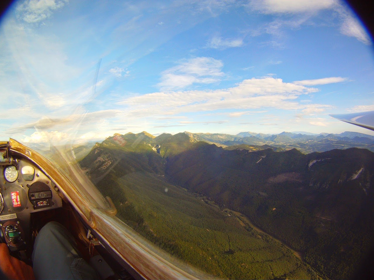
This year was the opportunity to discover a bit more Vercors mountains, with southern but also northern wind...


In term of big flight, weather was somehow choppy, still at the end of the stay it has improved & reasonnably nice flights were possible, to le Verdon or Les écrins.

I could check a few time that Pic de Bures Mountains is still the same serious-looking  moutain...


I was also happy to get my dad in Aubenasson's club Duodiscus to have a bit of "rock surfing".


 Also thanks to Christophe for letting me his nice Libelle - this was a first for me !


Well, those were nice holydays...

Sunday, December 8, 2013

Flying in Spain -2013

The now classical video from shot in spain in 2013.

Not the best weather ever this year, still some very nice flying experience, with friends or alone. There was a lot of north wind, hence very often wave related phenomenons... A good opportunity to test Butterfly vario !

Saturday, December 8, 2012

Shots from 2012 v2 : in mountains

Some other shots from flying Pyrénées mountains this year.

Saturday, November 24, 2012

Shots from 2012

A video made from various flights along past season...

Monday, October 22, 2012

Flying with tufts

On a blue thermal day, I spent some time adding whool tufts at wing/fuselage junction of my LS6. Here is the result :


The objective was to visualize flow separation in the root of LS6 glider.

Result : flow in wing fuselage junction is sensitive to aoa & aileron:flap deflection.
It can be observed in stall :
Separation occurs at lower fuselage attitude when flap increase. Tip : visualize this by looking at tail position vs horizon when separation appears.
It can be observed in normal flight :
In straight flight, separation is not visible. Very slight tuft activity on the fuselage sides.
While circling, separation occurs quite often, particularly on the wing inside turn. This is likely driven by the additionnal aerodynamic load brought by aileron offset ut of the turn to keep bank angle.

Next time :
Tufts should be applied on both sides It could be interesting to pull some G's to see what happens

Saturday, November 19, 2011

Video footage from past year

Here is a video assembling different flights over past season. Those shots were flown starting either from my "home airfield" of Moissac (LFCX) or from different flying trip : Jaca (LECI), Bailleau (LFFL) & Luchon (LFCB).

Sunday, October 23, 2011

Mountain flying + Family

We spent, as a family, a day in Luchon airfield (LFDH), that stands so to speak in the middle of Pyrénées mountains, on french side.


The weather was nice for the kids to play outside, and grass runaway was very welcoming...


For dad, autumn thermal where just right to discover this new area. I was also happy to fly over the slopes I had quite much flown with models.


Friends showed me the way to spain...


The most amazing thing was magical october's light !